3D scan for your property

One building. Two realities. Your property as a precise 3D model.

Services

Plan. Analyse. Understanding - with digital models that can do more.

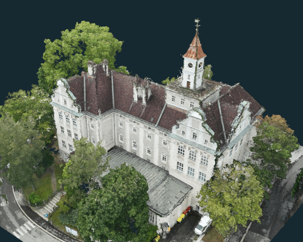
The 3D scan, also known as "Digital twin" is the most precise way of virtually modelling a building or site. Whether it's the exterior façade, roof structure or intricate interior spaces - laser scans and photogrammetric images taken with drones and indoor scanners create a detailed, true-to-scale 3D model.

These digital images enable a completely new way of working with property: from refurbishment planning, tenders and simulations to handover to architects or authorities - the digital twin provides the perfect database.
  • Compatible with any PC, tablet or smartphone
  • Manage properties digitally
  • Record defects
  • Retrieve logs & monitor deadlines

Services

Our technology: Inside and outside Perfectly connected

Drone-supported outdoor surveying

For roofs, facades and large areas, we rely on:
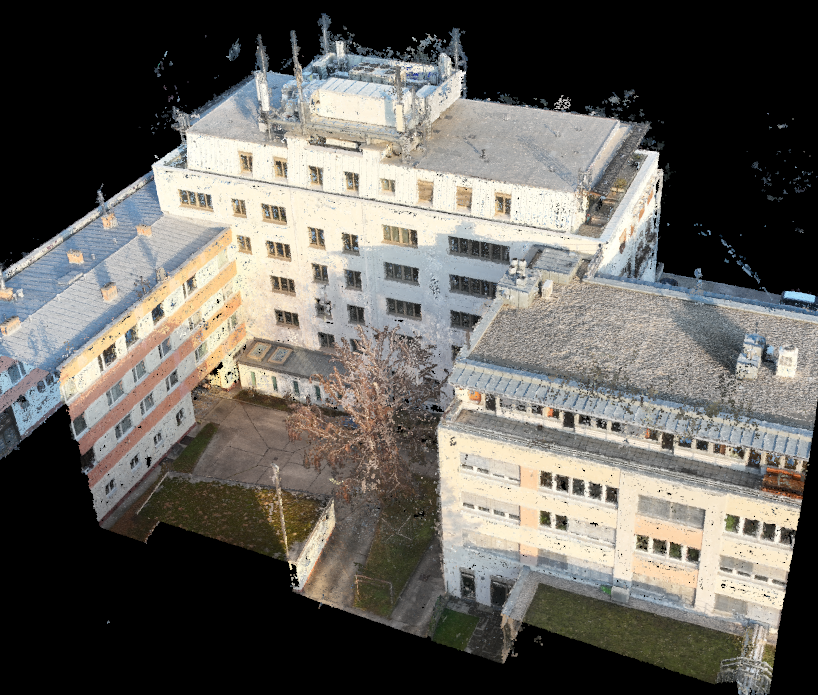
  • Photogrammetry (calculated from hundreds of individual images)
  • LiDAR laser scans (even under vegetation and in difficult lighting conditions)
  • Georeferenced flight paths for exact dimensional accuracy

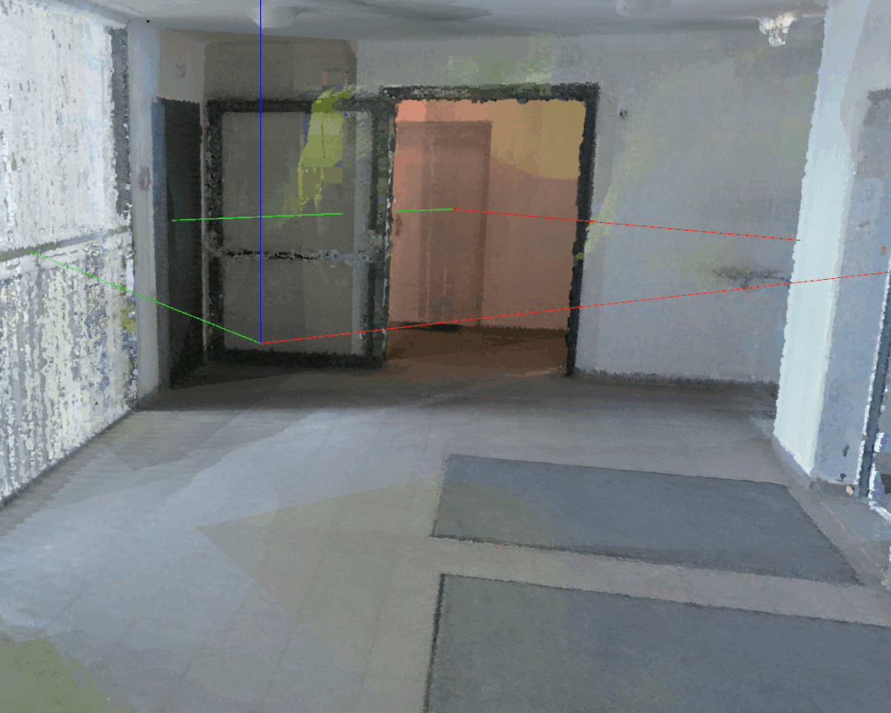
Indoorscan for the interior of buildings

We also record interiors with mobile laser scanners that generate point clouds with millimetre precision - even in complex floor plans, stairwells or basements.

Both models are merged together to create a seamless digital image of your property.

Areas of application

The areas of application at a glance

zero
Planning & remodelling
Architects work directly in the model
zero
Building authorities & authorisations
Clear visualisations instead of 2D plans
zero
Facility Management
Precisely allocate and record technical equipment
zero
Refurbishment & tendering
Exact quantity determination and service definition
zero
Fire protection planning
Virtual simulation of escape routes and fire compartments
zero
Insurance & appraisal purposes
Objective preservation of evidence

Your enquiry

ACCURACY IS A PREREQUISITE

Find out how you can use the digital twin for your project.

REFERENCES

Security is a matter of trust - our customers at a glance

FAQ

Questions and answers To the 3D scan at a glance

How does the digital twin promote sustainable planning in our infrastructure projects?

Laser scanning and photogrammetry provide precise data that is converted into 3D models. These enable precise material planning and minimise construction errors, which saves resources, reduces costs and minimises the ecological footprint of renovations or new buildings.

How does indoor laser scanning help to capture complex industrial facilities?

Indoor laser scanning creates detailed 3D images of production facilities, machines or pipework. This digital recording supports documentation, facilitates inventories and forms a reliable basis for conversion or maintenance planning.

How precise is the data for our digital planning processes?

The digital twin offers accuracy in the millimetre range, ideal for digital planning. The data is compatible with common planning platforms and minimises deviations between the planned and actual condition of buildings or systems.

How does the digital twin facilitate the modernisation of existing buildings?

The digital twin quickly and precisely records the current condition of buildings without time-consuming manual measurements. The resulting 3D models enable reliable planning of conversions, reduce unexpected challenges and save time.

How does laser scanning support the creation of digital twins for industrial companies?

Laser scanning depicts real systems in highly accurate 3D models that serve as digital twins. These enable simulations, process monitoring and predictive maintenance in order to optimise operational efficiency and plant safety.